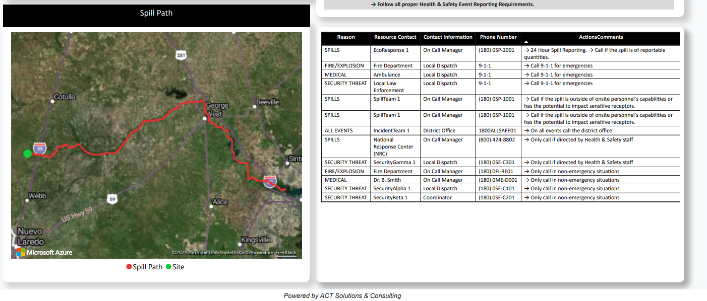
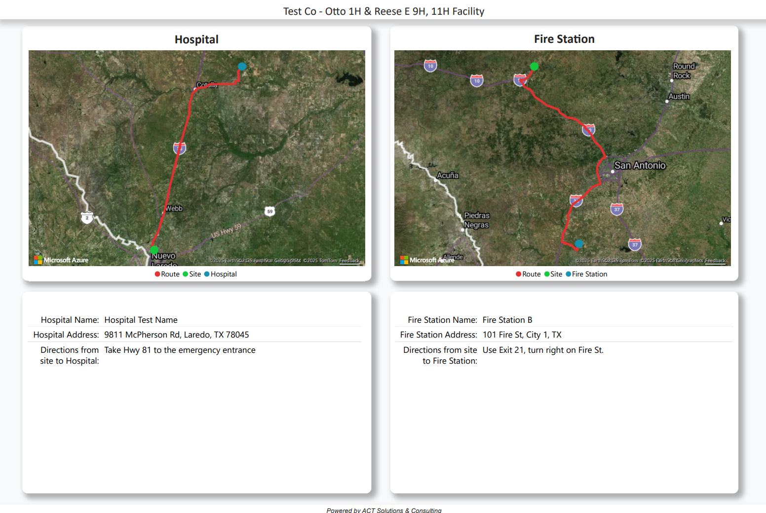
Response+ BETA


Respond Rapidly. Accessible Site Information. Reliable Incident Management.

  THE PRODUCT

Streamlining On-Site Incident Management and Simplifying Response Protocols

Response+ is a streamlined incident response solution that transforms complex emergency protocols into clear, actionable instructions. Designed for on-site personnel, site managers, and emergency coordinators, it ensures that everyone on-site is equipped with the vital information needed to respond swiftly and effectively during emergencies.
Screenshot 1 Screenshot 2


  THE PROCESS

Scale Icon

Key Features & Benefits
  • Site-Specific Emergency Information – Each site record includes GPS coordinates, nearest hospitals, fire stations, access roads, and comprehensive contact details for fire, medical, and spill response teams.
  • Template-Driven Data Entry – Standardized input templates ensure consistent, accurate site data collection across all locations, reducing manual entry errors and improving usability.
  • Printable Emergency Dashboards – Generate clean, easy-to-read PDF dashboards summarizing all critical emergency response data. Ideal for printing and sharing with contractors and non-regular site visitors.
  • Standardized Emergency Protocols – Streamline emergency procedures across all sites to support faster, more coordinated incident response.
  • Centralized Access & Quick Reference – All emergency data is organized in one place, making it easy for teams to access vital information during critical events—whether on-site or remote.
  • Improved Safety & Incident Response – By reducing confusion and delays during emergencies, Response+ enhances team readiness and overall safety outcomes.
  • Operational Efficiency at Scale – Easily manage and update emergency protocols across multiple sites through a centralized, user-friendly platform.

By centralizing emergency site data, standardizing response protocols, and enabling rapid information access, Response+ empowers organizations to enhance safety, improve coordination during critical incidents, and streamline emergency preparedness across all operational sites.

See it in action  

  KEY FEATURES


Spill Path

Driving routes

Critical Emergency Contact Information

  INTEGRATIONS


ArcGIS

Google Maps

Microsoft Azure

Excel